
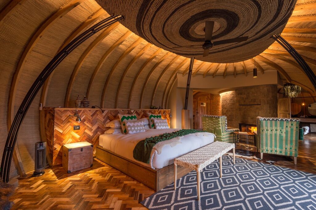
Bisate Lodge Luxury Villas for Rwanda Gorilla Trekking Bisate Lodge is an exclusive luxury lodge bordering Volcanoes National Park in northwestern Rwanda. Set within a dramatic natural amphitheatre formed by ancient volcanic cones, the lodge enjoys sweeping views across the Virunga Mountains. The journey to the lodge winds through rural villages before climbing into a […]
28
Jul
Jul
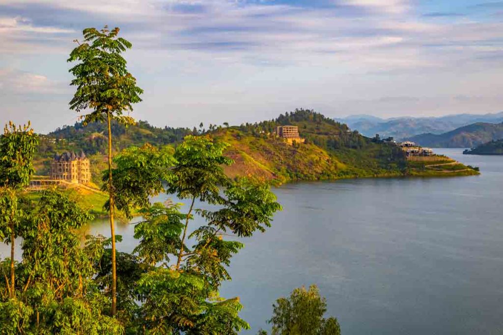
Why visit Kibuye and what to do in Kibuye? Rwanda city visits and tours in and around Lake Kivu. Adding Kibuye to your Rwanda holiday gives you the thrill that was missing on your Rwanda safari program. Kibuye is one of Rwanda’s most beautiful towns and best tourism destination. It is located in the western […]
19
Jun
Jun
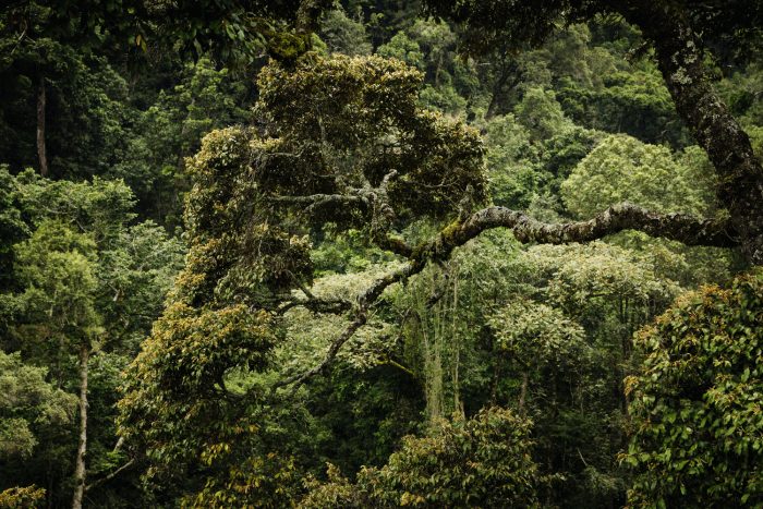
Recently the Rwanda government confirmed that the Gishwati-Mukura forest reserve has become the country’s 4th National Park and it is expected to help boost the tourism business in the country. It will also act as a resource for researchers, conservationists therefore help in the environment and the ecosystem preservation or protection. This has come a […]
11
Sep
Sep
This is a very dense forest and vast part of the great Ituri Forest that stretches in the DR.Congo, It is the only in Uganda composed primary of tropical lowland forest, land is quiet flat and creating a startling contrast to the rugged Rwenzori mountains nearby. There are a number of animals in the park […]
11
Sep
Sep
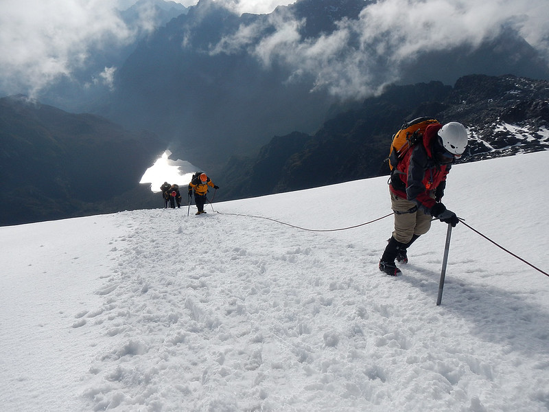
The 120km Ruwenzori chain is regarded to be the legendary snow-capped Mountains of the Moon, described by Ptolemy in AD150. Reaching an elevation of 5,109m, it is also Africa’s tallest mountain range, exceeded in altitude only by the free-standing Mount Kenya and Kilimanjaro. The distinctive glacial peaks are visible for miles around, but the slopes […]
11
Sep
Sep
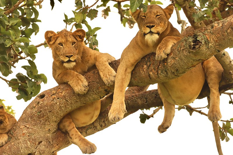
Queen Elizabeth national park. Queen Elizabeth national park, is Uganda’s most visited game reserve and it’s the second biggest national park, it boarders DRC on its western side lying on the base of the rift valley between lake George and Edward. It’s known for the big four animals those are the lions, elephants, the buffaloes […]
Murchison Falls National Park is Uganda’s largest national park, covering approximately 3,893 km² within the wider Murchison Falls Conservation Area, which extends to about 5,072 km² together with Bugungu Wildlife Reserve and Karuma Wildlife Reserve. Located in northwestern Uganda at the northern edge of the Albertine Rift Valley, the park stretches from the shores of […]
Uncategorized
Mount Elgon National Park
Elgon is a 4,321m high extinct volcano which in prehistoric times stood taller than Kilimanjaro does today. Although the mountain straddles the Kenya border, its loftiest peak, Wagagai, lies within Uganda and is best ascended from the Uganda side. Elgon is an important watershed, and its slopes support a rich variety of altitudinal vegetation zones […]
Mgahinga Gorilla National Park in Kisoro, Uganda Mgahinga Gorilla National Park is Uganda’s smallest national park, covering 33.7 km² in Bufumbira County, Kisoro District, in the country’s far southwestern corner where Uganda meets Rwanda and the Democratic Republic of Congo. The park occupies the Ugandan slopes of 3 extinct Virunga volcanoes, Mount Sabyinyo (3,645 m), […]
Uncategorized
Lake Mburo National Park
This is lying in one part of Uganda and covered in extensive acacia woodland, Ithas markedly different fauna to other reserves. It is the best place in the country to see the gigantic eland antelope, as well as zebra, impala, and many other acacia-associated birds. There are five lakes within the park which attract hippos, […]
- 1
- 2