
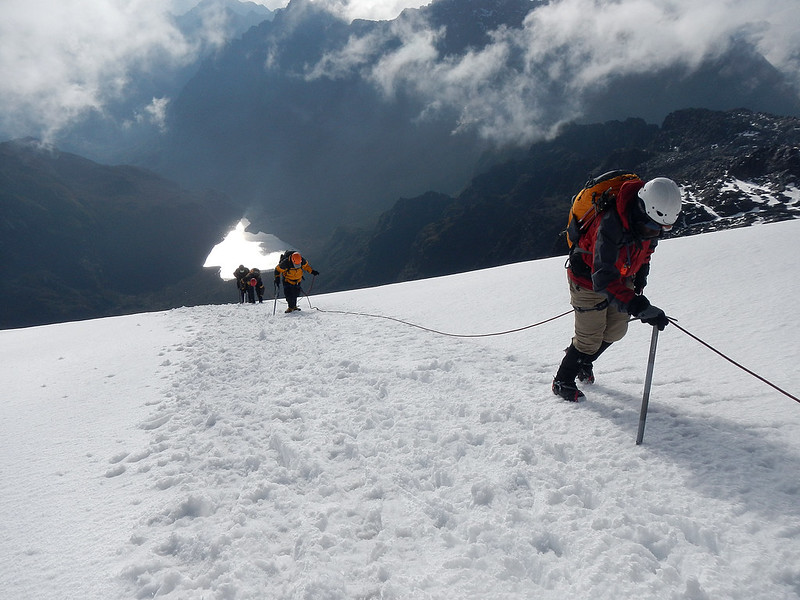
Rwenzori Mountains National Park rises along Uganda’s western border with the Democratic Republic of Congo, where the mountain range continues into Virunga National Park. This is one of the most dramatic mountain landscapes in Africa, covering 99,600 hectares, or 996 square kilometres, across Kasese, Kabarole and Bundibugyo districts.
About 70 percent of the park lies above 2,500 metres, so you enter a real high-altitude world as soon as the climb begins. The wider Rwenzori range stretches for about 120 kilometres and reaches roughly 65 kilometres across at its widest point. Down below, the land feels warm and green. Higher up, the mountain changes quickly, with deep valleys, rocky ridges, fast-flowing rivers, waterfalls, mountain lakes and glacial peaks.
The highest point is Margherita Peak on Mount Stanley, standing at 5,109 metres above sea level. It is Uganda’s highest summit and Africa’s third-highest peak after Mount Kilimanjaro and Mount Kenya. Reaching Margherita is a serious mountain climb, but you do not have to stand on the summit to feel the power of the Rwenzoris. Even the lower and middle routes take you through montane forest, bamboo zones, heather-covered slopes, misty valleys and wide moorlands before the land becomes colder, steeper and more exposed.
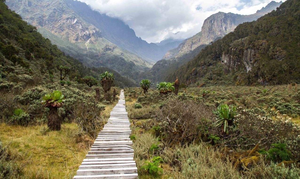
What makes walking in the Rwenzoris so special is the way the mountain changes as you climb. One moment you are under dense forest, listening to rivers and birds. Then the trail opens into bamboo, moss-covered rocks, sphagnum bogs, giant tree heathers, groundsels and tall lobelias. Higher still, you meet dark cliffs, clear mountain lakes, waterfalls, snowfields and the remaining equatorial glaciers. It feels like you have moved far away from the warm plains of western Uganda.
Rain and mist are part of the Rwenzori experience. The local meaning of Rwenzori as “Rain-Maker” or “Cloud-King” fits the mountain well. Clouds gather around the peaks, streams run down through the valleys, and rivers from these slopes support farms, homes and communities across western Uganda. The mountains are also an important water catchment and are among the highest permanent sources feeding the River Nile.
UNESCO, Ramsar Status and Bakonzo Culture
Rwenzori Mountains National Park was gazetted in 1991 and became a UNESCO World Heritage Site in 1994 because of its exceptional scenery, altitudinal vegetation and threatened species. It was later recognised as a Ramsar Wetland of International Importance, with 13 May 2009 recorded as the Ramsar designation date. The mountains also carry deep cultural meaning for the Bakonzo communities who live along the lower slopes. A visit here can include village walks, homestead visits, cultural performances and locally prepared meals. These experiences help you understand the mountain beyond the trail. You see how people live with the rain, the slopes, the gardens, the rivers and the changing moods of the Rwenzori.
Rwenzori Mountains Trekking and Climbing Routes
Trekking is the real way to enter the Rwenzori Mountains. Roads can take you to the lower slopes, but they do not carry you into the high valleys, moorlands, glacial lakes or snow zones. From there, the mountain asks you to go on foot, step by step, with the sound of rivers below you and mist moving through the ridges.
The journey starts in warmer lower slopes, where you pass forest, village edges and mountain farms. Children can call as you walk past the communities, and soon the trail leaves the everyday world behind. You climb through montane forest, bamboo, wet valleys, giant heathers and Afro-alpine vegetation before reaching the colder rock, snow and ice around the highest peaks.
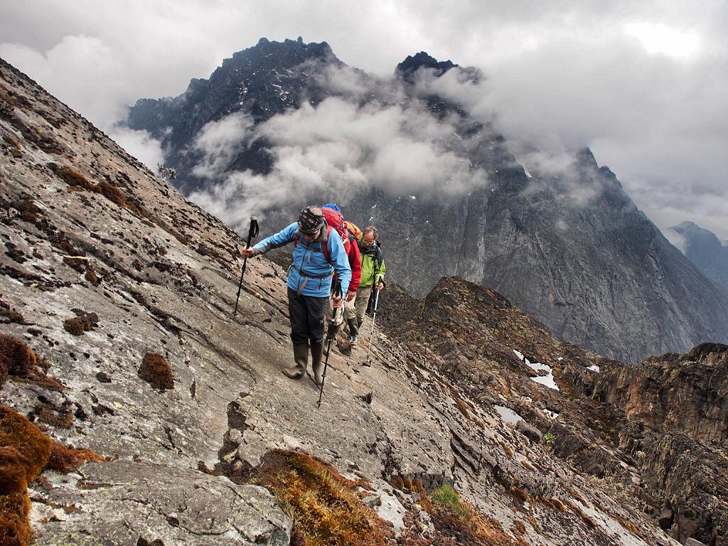
The Rwenzoris are not ordinary walking country. You need good fitness, balance and patience for long walking days, steep climbs, wet ground and changing altitude. Mud, rain, cold air, slippery boardwalks and sudden weather changes are all part of the mountain. This is not a place to rush. You move steadily, let your body adjust, and watch the landscape change around you as the climb gets higher and wilder.
How Difficult Is Trekking in the Rwenzori Mountains?
The difficulty depends on the route, number of days and highest point you want to reach. Lower-slope walks and shorter treks are good for travellers who want forest, waterfalls, birds and unusual vegetation without climbing the major peaks. Longer expeditions need stronger endurance because you walk for several days at altitude, crossing bogs, ridges, valleys and colder mountain zones.
Margherita Peak on Mount Stanley stands at 5,109 metres and is the highest point in Uganda. This is not a normal hike. The final climb is a serious mountain ascent across steep rock, snow and glacial terrain. Ropes, crampons, ice axes and experienced mountain support are needed for this section.
You do not have to arrive as an expert winter climber, but previous experience on snow, ice or exposed mountain ground gives you a stronger chance on the summit attempt. The mountain decides many things for you. Weather, glacier conditions, altitude and your body all matter. No responsible guide promises that every climber will reach the top. Sometimes turning back is the safest and smartest mountain decision, even after several hard days on the trail.
Rwenzori Trekking Itineraries from 1 to 12 Days
Rwenzori treks can run from 1-day lower-slope walks to full expeditions of up to 12 days. This gives you room to choose a trek that fits your fitness, time, and interest in the mountain.
Shorter trips focus on forest trails, waterfalls, community areas and lower vegetation zones. These are good if you want to feel the Rwenzoris without going deep into the high-altitude sections. Mid-length routes take you farther into the valleys and moorlands, where giant lobelias, groundsels, mountain lakes and endemic birds become part of the walk.
Longer climbs take you to the higher camps, colder valleys and major peaks. They also give your body more time to adjust to altitude. Private trekking routes can be extended with extra nights, which helps you rest between difficult stages, enjoy the quiet of the mountain and avoid rushing from one camp to the next.
Central Circuit Route from Nyakalengija
The Central Circuit begins at Nyakalengija, near the Mubuku Valley. This is the best-known historical route into the high Rwenzoris. It became famous after Luigi Amedeo di Savoia’s 1906 expedition and remained the main access route into the mountains for many years.
The trail forms a circuit through some of the range’s best-known valleys, lakes and mountain camps. You walk through forest, bamboo, heather and boggy highlands before reaching areas below Mount Baker, Mount Speke and Mount Stanley. Side climbs can be added for trekkers who want to attempt individual peaks.
The Central Circuit is a good choice if you want a recognised circular route with strong history and classic Rwenzori scenery. It is beautiful, but it is also demanding. Wet ground, deep bogs, ladders, boardwalks, steep climbs and long walking days all form part of the journey.
Kilembe Trail Rwenzori Trekking Route
The Kilembe Trail begins near Kilembe and enters the mountains from the southern side of the range. This route is loved by trekkers who want strong scenery, a steady climb, and enough time to adjust as the altitude increases.
A full expedition toward Mount Stanley can take about nine days. A shorter six-day climb can lead toward Mount Luigi di Savoia. The route gives you a rich mountain journey, with rivers, valleys, ridges, higher camps, and some of the most dramatic vegetation in the Rwenzoris.
One of the beautiful things about the Kilembe Trail is how quickly the landscape changes. By the end of the first day, trekkers can reach the giant heather zone. From there, the route continues toward wider valleys, mountain rivers, lobelias, groundsels, and higher mountain camps.
This trail works well for travellers who want more than a quick mountain walk. It gives you time to settle into the rhythm of the Rwenzoris. You climb slowly, breathe deeply, cross wet ground, and watch the mountain plants grow stranger and bigger as you move higher.
Bukurungu Trail and Mount Gessi
The Bukurungu Trail gives another way into the Rwenzoris, leading toward the Mount Gessi side of the range. It is less widely used than the Kilembe and Central Circuit routes, which gives it a quieter and more secluded feeling.
This route suits trekkers who want a more peaceful mountain experience, away from the busier approaches. The feeling is more remote, and the journey gives you time to connect with the landscape without meeting many other groups on the trail.
January and the drier period from June to July give stronger climbing conditions in this section. Even then, the Rwenzoris remain wet mountains, and rain can still fall at any time. Trekkers should arrive ready for muddy ground, mist, sudden changes in visibility, and cooler mountain weather.
Best Things to Do in Rwenzori Mountains National Park
Rwenzori Mountains National Park is a place you experience on foot. This is not a park where you only sit in a vehicle and watch the scenery pass. Here, you walk into the mountains slowly, step by step, as the land changes around you.
You can spend several days climbing toward snow-covered peaks, take a shorter forest hike through the lower slopes, look for Albertine Rift birds, or walk through Bakonzo villages at the foot of the range. Some travellers come for Margherita Peak. Others come for forest walks, waterfalls, birds, culture, and the feeling of standing below one of Africa’s most powerful mountain ranges.
The right activity depends on your fitness, your time, and how high you want to climb. The Rwenzoris reward slow movement. You do not rush these mountains. You listen to the rivers, feel the wet ground under your boots, watch the vegetation change, and let the mountain reveal itself properly.
Mountain Trekking and Peak Climbing in the Rwenzori Mountains
Mountain trekking is the main activity in the Rwenzoris. The trails start from cultivated foothills and rise into montane forest, bamboo, giant heather, boggy valleys, and Afro-alpine moorland before reaching the rock, snow, and glaciers around the highest peaks.
This is where the Rwenzori experience becomes serious. The mountain is beautiful, but it asks for patience, strength, and respect. Some parts are muddy. Some days are long. The weather can change quickly. You can start a walk under clear skies and later find yourself moving through mist, rain, cold air, and slippery ground.
Margherita Peak stands at 5,109 metres on Mount Stanley. Reaching the summit is not an ordinary hike. It requires strong fitness, endurance, and the ability to keep moving through cold, wet, steep, and difficult terrain. Climbers need to prepare for long walking days, muddy trails, changing weather, and technical sections close to the peak.
The Central Circuit from Nyakalengija can take about seven days for a basic journey into the Mount Stanley area. Programmes that include a Margherita Peak attempt generally take eight to nine days, giving climbers more time to gain altitude and prepare for the summit stage.
For those who are ready, peak climbing in the Rwenzori Mountains is one of Uganda’s strongest mountain experiences. You are not only climbing for the summit. You are walking through a landscape that changes almost every day, from forest and bamboo to giant plants, cold valleys, glaciers, and high rocky ground.
Short Rwenzori Hikes to Sine Hut
You do not need to climb Margherita Peak to enjoy the Rwenzori Mountains. Shorter hikes can still give you a strong taste of the mountain, especially if you want a demanding walk without committing to a full summit expedition.
One of the good shorter treks takes you to Sine Hut at approximately 2,596 metres. This route gives you a chance to move from the lower forest into cooler mountain vegetation, where the trees become mossy, the air feels fresher, and the slopes begin to show the real character of the Rwenzoris.
Along the way, you can see waterfalls, forest birds, monkeys, moss-covered trees, and thick vegetation. The lower Rwenzori slopes feel very different from Uganda’s savannah parks. Here, the beauty is in the forest, the dripping leaves, the roots under your feet, the calls in the canopy, and the quiet power of the mountain.
Even a short hike needs proper preparation. Good walking shoes, rain protection, and a steady pace are important. The trails can stay wet after rainfall, and the roots, mud, and steep sections can make the walk more tiring than the distance suggests.
Birdwatching in the Rwenzori Mountains
The lower forests and mountain slopes of the Rwenzoris are rewarding places for birdwatching. This is a strong area for Albertine Rift species, with around 19 Albertine Rift endemic species associated with the region.
The Rwenzori turaco is one of the main birds travellers hope to see. It is known for its deep colours and loud calls in the forest canopy. When you hear it calling above the trees, the forest suddenly feels more alive.
Other birds associated with the Rwenzori region include the Rwenzori double-collared sunbird, Rwenzori nightjar, Rwenzori batis, handsome francolin, strange weaver, Archer’s robin-chat, red-throated alethe, red-faced woodland warbler, montane masked apalis, lammergeier, and red-thighed sparrowhawk.
Birding is best enjoyed slowly. The lower-slope walks give you time to stop, listen, and scan the canopy. You do not rush through the forest looking only for names. You pause, follow the calls, watch movement in the leaves, and let the guide help you pick out the birds that are easy to miss.
Birdwatching can be combined with forest hiking from both Kilembe and Nyakalengija. It does not have to be treated as a separate full-day activity unless birds are your main reason for visiting.
Nature Walks from Kilembe and Nyakalengija
Nature walks give you a closer look at the forests, rivers, wildlife, and communities around the lower Rwenzori slopes. These walks can begin from the Kilembe or Nyakalengija trailheads and continue through forest paths, cultivated areas, and foothill villages.
Walking options include the route toward Lake Mahoma, the Buraro chimpanzee forest, the communities of Kichamba, and the Karangura Ridge. Longer walks can continue toward Bundibugyo through Bwamba Pass, where the land opens toward the western side of the range.
These lower walks are good for travellers who want the mountain atmosphere without committing to a long trek. You still feel the forest, hear the rivers, pass through local communities, and see how life sits at the base of the Rwenzoris.
Wildlife seen along these trails can include colobus monkeys, vervet monkeys, squirrels, and the three-horned chameleon. Sightings depend on movement, weather, and time spent in the forest, so the walk itself remains the main experience. The birds, vegetation, river sounds, mountain views, and quiet forest moments are part of what makes the lower slopes special.
Bakonzo Cultural and Community Walks
The Bakonzo people have lived along the foothills of the Rwenzori Mountains for generations. Their homes, farms, stories, rivers, and traditions are closely connected to the mountains. A cultural walk here helps you understand that the Rwenzoris are not only peaks and glaciers. They are also home.
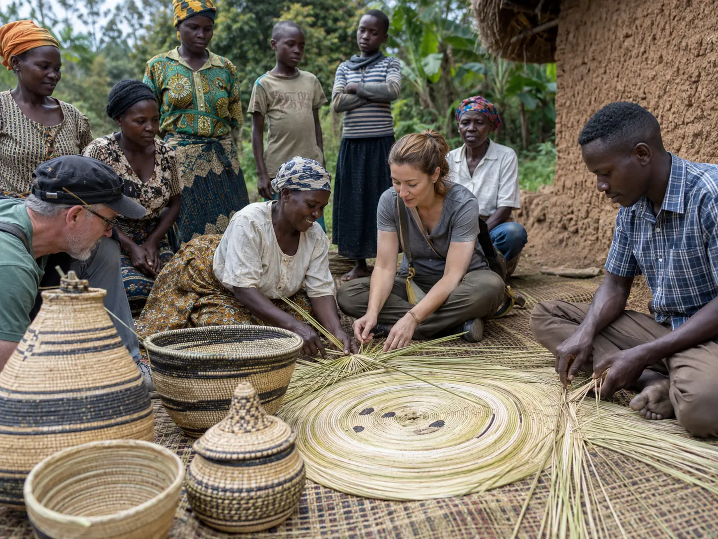
Community walks around Ruboni, Mihunga, and nearby settlements give you time to see how families farm, prepare food, make handicrafts, and use the mountain’s rivers and plants in daily life. You may walk past gardens, homes, footpaths, and children greeting you along the way, while the peaks rise quietly above the villages.
Activities can include traditional dance performances, drumming, storytelling, and demonstrations of hand-fishing in the streams. Some visits also include conversations with local healers who explain how plants and inherited knowledge are used within the community.
The Bulemba-Ihandiro Cultural Trail passes through places with spiritual importance for the Bakonzo. The route includes Bat Valley, regarded as a sacred place, and crosses the River Kamusonge before continuing through village landscapes below the mountains.
Ruboni and Mihunga also provide access to guided forest walks outside the park boundary. These experiences work well before or after a mountain trek because they help you understand the people whose homes, gardens, and traditions live beneath the peaks.
How to Get to Rwenzori Mountains National Park
Getting to Rwenzori Mountains National Park by Road
There are two main road routes from Kampala to the Rwenzori Mountains. The shorter northern route covers about 375 kilometres. It goes through Fort Portal before continuing towards Kasese and the Ruboni side of the mountains. This is a good route when your trek starts near Ruboni or Nyakalengija, and it gives you a direct approach to the northern foothills of the Rwenzori.
The southern route covers about 450 kilometres. It travels through Mbarara and Queen Elizabeth National Park before reaching Kasese. This route is longer, but it works very well when you want to combine the Rwenzori Mountains with wildlife viewing in Queen Elizabeth National Park. You can move from the savannah plains into the mountain country, which gives the journey a strong Uganda safari feeling.
The drive from Kampala to Kasese takes about 5 to 6 hours, but the journey can take longer depending on traffic, road conditions, and stops along the way. We always advise leaving early, so you are not rushing the final section into the foothills.
Public transport is available to Kasese, but for a Rwenzori trek, a private vehicle gives you a smoother and more comfortable transfer. It also makes it easier to continue directly to your hotel, lodge, or trailhead without waiting around in town.
A four-wheel-drive vehicle is the better choice for the final approach, mainly during heavy rains. Roads near the foothills can become muddy, rough, and slow. From Kasese, you continue by road to Ruboni, Nyakalengija, Kilembe, or your chosen accommodation before the trek begins.
Flying from Entebbe or Kajjansi to Kasese
If you want to reduce the long road journey, you can take a chartered flight from Entebbe International Airport or Kajjansi Airfield to Kasese.
The flight takes about 1 hour and 30 minutes, which gives you more time to rest before your mountain trek. After landing in Kasese, a road transfer can be arranged to your hotel, Ruboni, Kilembe, Nyakalengija, or the selected park entrance.
Flying works well when your Uganda itinerary is short, or when you want to save your energy for the mountains. It is also a good option after a demanding multi-day Rwenzori trek, when another long road journey can feel heavy on the body.
Whether you travel by road or by air, Kasese is the main gateway. From there, the journey becomes more local and more personal. The road moves closer to the mountain villages, the air feels cooler, and the peaks begin to rise ahead of you as you approach the Rwenzori foothills
Where to Stay Near Rwenzori Mountains National Park
- Park entrance bunkhouse
Basic accommodation beside the national park headquarters and trekking offices. Meals can be arranged through a local women’s group. - Ibanda village guesthouse
Located about 4 kilometres from the park entrance, with comfortable beds, bedding and secure vehicle parking. - Ruboni accommodation
A convenient base near the Nyakalengija trailhead, with access to guided community walks, forest trails and transport connections from Kasese. - Kasese accommodation near the Kilembe road
Several hotels stand about 3 kilometres west of Kasese town, giving trekkers straightforward access to Kilembe and the southern trekking route. - Kasese residential-area hotels
Quieter accommodation outside the busy town centre, with different room categories for travellers staying before or after a mountain trek. - Central Kasese hotels
Suitable for travellers who want easy access to restaurants, shops, taxis, trekking offices and onward transfers to the park. - Mitandi accommodation
Set away from the main tourist trail at about 1,800 metres above sea level, with access to local culture and trekking routes towards Mount Karangura. - Mountain huts and camps
Multi-day trekkers sleep in simple huts or fixed camps along the selected route. Facilities are basic, so expect shared sleeping spaces, limited washing facilities and simple mountain meals.